Observing the earth
Satellite images and geographic data provide an important resource for predicting, identifying and observing natural disasters and for coordinating prevention measures and relief efforts.
One class of earth observation instruments are optical detects of solar energy, reflected back from earth, into space across various wavelengths, including visible light and invisible infrared bands. Radar instruments shine microwave or lazer pulses down to earth in order to record the time the microwave pulses take to be reflected back to the satellite, thus measuring land and sea height to an accuracy within a few centimeters. The higher the resolution of the data, the smaller the area that can be observed.
Satellites are installed and satellite data are provided by a cooperation of governmental public research institutions and private companies. The national space stations play a leading role in providing satellite data on natural disasters such as, the NASA and ESA European Space Agency. Different NGOs and organs of the UN have been founded to bundle this data and make it publicly available to the humanitarian community and disaster management professionals in order to support disaster prevention and relief efforts.
UNOSAT is the organ of the UN that makes satellite data and geographic information accessible to the humanitarian community in the hopes to employ them for disaster reduction and sustainable development. The usability of the data is enhanced by the production of maps, methodological and technical assistance, training and projects.
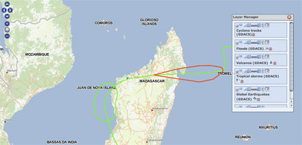
OCHA, the UN Office for Coordination of Humanitarian Affairs, has installed the GDACS Global Disaster Alert and Coordination System, an information system and news site that announces acute natural disaster reports, and provides members of emergency response teams and affected communities with alert SMS and e-mail messages. The mapping material displays complete overviews of natural disasters around the globe and their estimated impact, indicating the amount of attention that should be paid by relief organizations. The exchange of information, discussion and decision making about relief measures and coordinating international response and mobilization of the UNDAC takes places on the virtual OSOCC, a communication platform for stakeholders of disaster management.
The IASC Inter Agency Standing Committee who coordinates the activities of different UN agencies and NGOs has installed a similar site, HEWS Humanitarian Early Warning Service, also depicting natural and socio-political crisis.
The DMA Digital Map Service is the scientific body of the EU which provides the scientific background for coordinating the EUs external aid funding efficiently, while integrating the capacities and independent of the views of governments, research institutions and companies.
Respond GMES Services Supporting Humanitarian Relief, Disaster Reduction and Reconstruction is an initiative of he European Commission and the ESA with a mission to provide a world database mapping, and to continuously update mapping in areas of crisis, in order to enhance efficiency of European and international emergency response.
Map Action is an NGO made of cartographers offering their services to disaster devastated regions. Some research programmes focus on the survey of only one aspect that can be surveyed by the data obtained from satellites, e.g. ENVOC Envisat Oceanography deals with analyzing meteorological conditions on the ocean, e.g. freak waves. Envisat is a satellite with various instruments currently sent into space by the ESA.


